Tracklogs
Advertisement
TrackLogs Digital Mapping v.3.15.1
TrackLogs Digital Mapping include genuine Ordnance Survey digital data and are visually identical to the paper Explorer and Landranger maps. The maps show footpaths, bridleways and contours, just like the paper ones.
Gps2jpeg v.4.0
Insert exif data in your jpeg images with this software. gps2jpeg is Esse program insere as tags exif de latitude, longitude e altitude em imagens jpeg realizando o geo-posicionamento das imagens, para isto utiliza tracklogs de aparelhos de GPS With
Advertisement
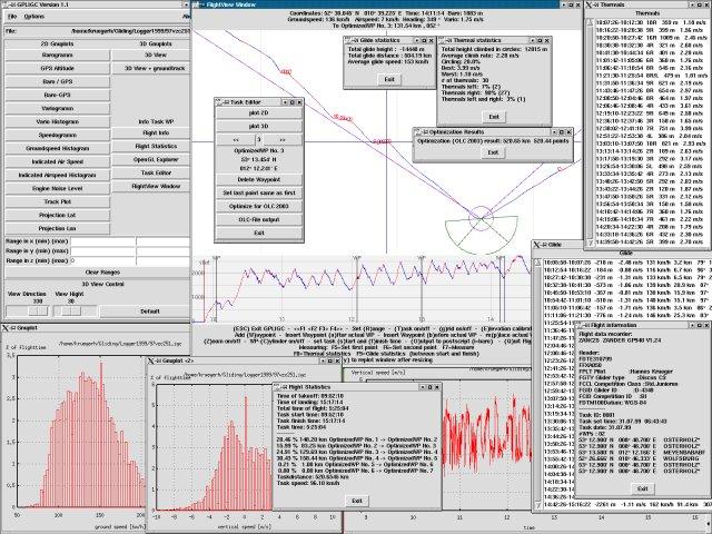
GPLIGC v.rc
GPLIGC is a program for analysis and 3D visualization of GPS tracklogs (in igc format) as recorded by flight data recorders used by glider pilots.
OziPhotoTool v.2 8
OziPhotoTool combines the technology of a GPS receiver and a digital camera to automatically keep a record of where digital photos were taken. It is designed to be used in conjunction with OziExplorer.
Mercatalog v.1.0.1
Find photos right where you took them.